
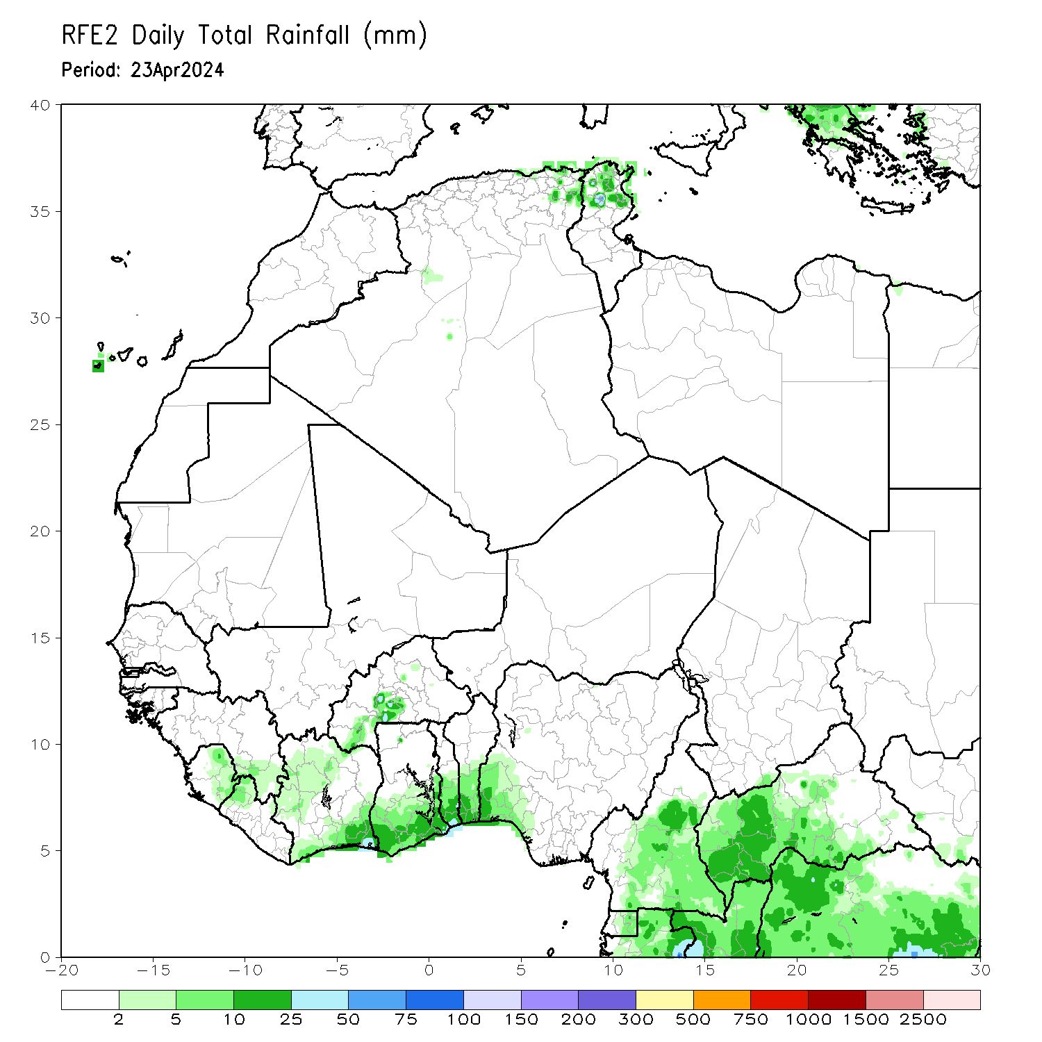
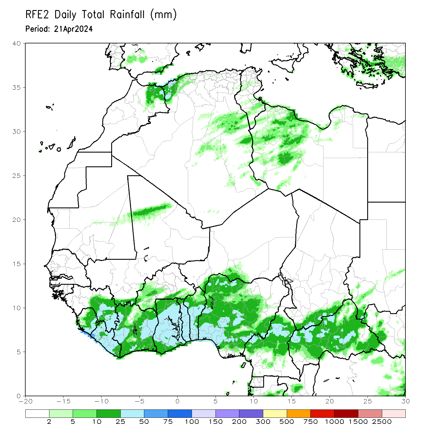
The next four maps show the four most recent Satellite-derived daily rainfall estimates for West Africa.
a) most recent daily estimate - total rainfall in mm |
b) daily estimate, 1 day before a) |
 |
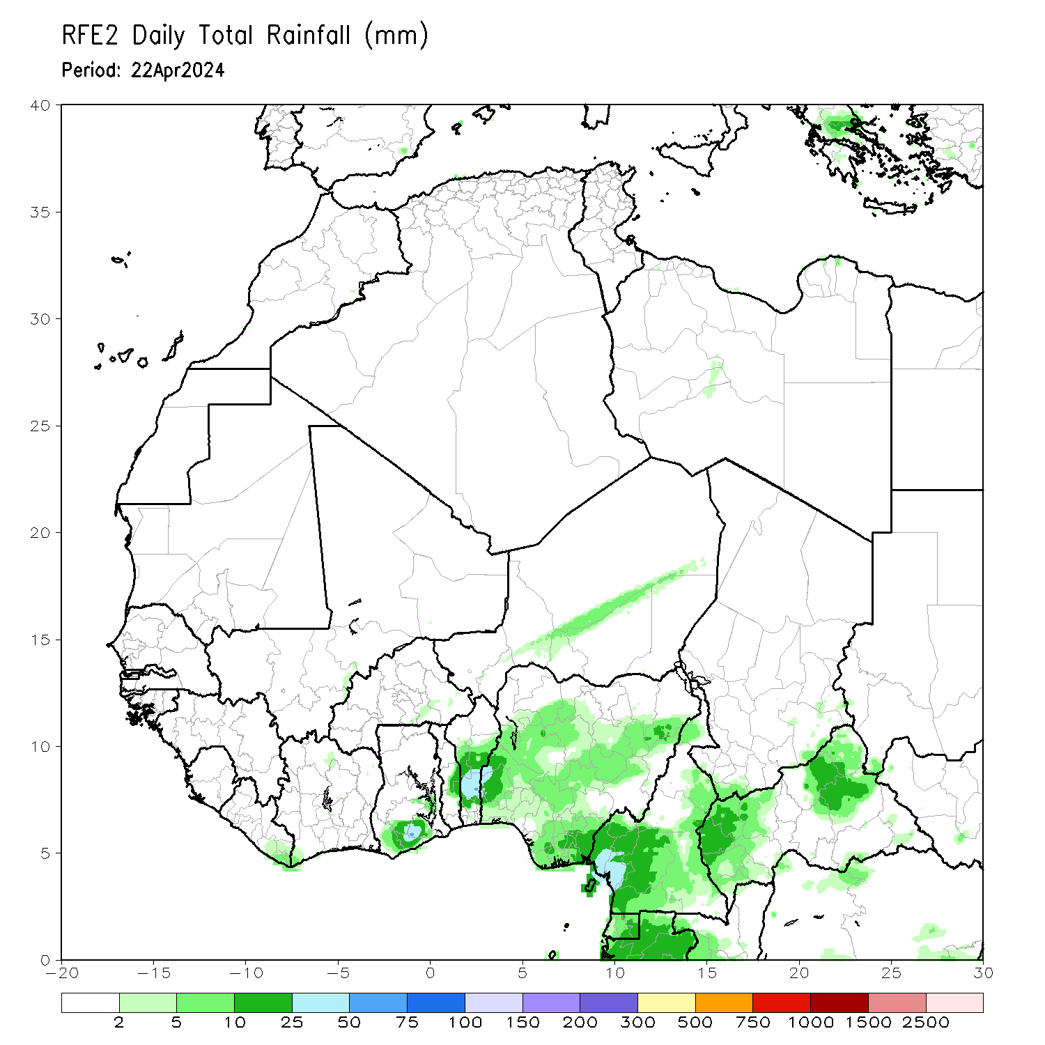 |
c) daily estimate, 2 days before a) |
d) daily estimate, 3 days before a) |
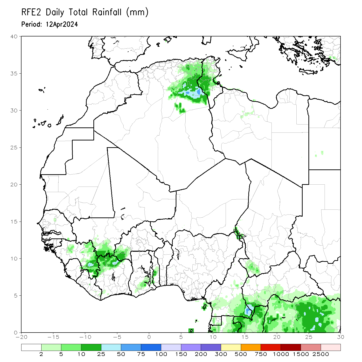 |
 |
| Satellite-derived rainfall estimates; source NOAA/FEWS | |
The total estimated rainfall is also given for last week:
Last week - total rainfall in mm |
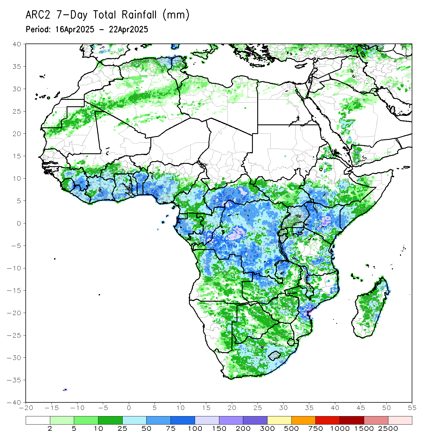 |
| Satellite-derived rainfall estimates (ARC2); source NOAA/FEWS |
All maps above give rainfall estimates in mm, but to know whether the rainfall was above or below the long term-average, the results need to be presented in a different way. Therefore recent rainfall is presented as a deviation from the long term-mean from the years before. This can be expressed by an absolute difference (deviation from the mean) in millimetres of estimated rainfall or by a relative difference showing the percentage of deviation from the long term-mean. Both types of information are displayed in the two maps underneath:
Absolute difference to long term-mean in mm |
Relative difference to long term-mean as % deviation |
 |
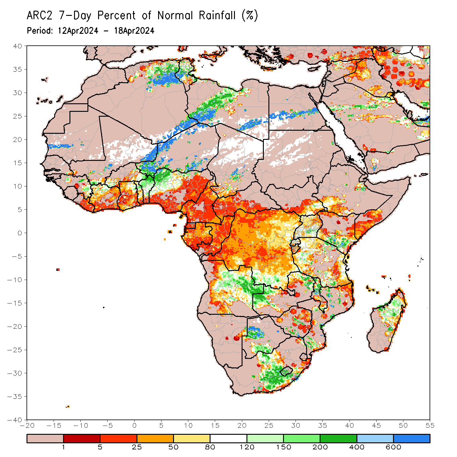 |
| Satellite-derived rainfall estimates (ARC2); source NOAA/FEWS | |